

20 geography discoveries · Ages 4–8 with a grown-up
Wonder with
Olivia & Doudou.
Twenty illustrated geography discoveries with Olivia & Doudou. Explore Earth and weather, follow land and water, connect places with maps and bridges, and tell a thoughtful journey through a community.
Our Wonderful World: an explorer’s notebook
Begin with the original eight-page notebook, then choose picture conversations from ten additional discoveries. Add only the clues, routes and shared places that help your child’s map or spoken journey.
Ideas that connect
Choose your next little adventure.
Follow a suggested sequence, then choose another discovery when a new question catches your attention.
5 discoveries
Our place on Earth
How can we describe our planet and the weather in its places?
 Follow this journey
 4 discoveries
Follow land and water
How do land, water and growing places connect?
 Follow this journey
 8 discoveries
Help people find a way
How can pictures, maps and crossings help us connect places?
 Follow this journey
 3 discoveries
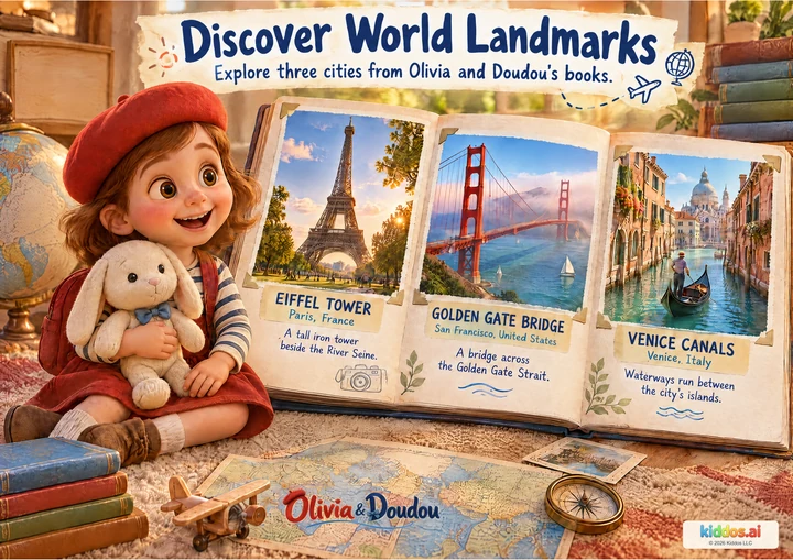
Tell a journey
What makes a destination useful or recognizable, and how can we care for it?
 Follow this journey
 A small rhythm to share
A conversation can be enough.
- 1
A short visit
Choose one poster and one question for 5–10 minutes. Stop after one useful observation; return when the child wants to.
- 2
Four chapters
Use one chapter at a time over several visits. Open the related notebook page only when it helps the conversation.
- 3
A classroom sequence
Choose from twenty posters. Use 10–15 minutes for a picture conversation; complete classroom activities take the 15 or 20 minutes shown in each guide. The original eight-page notebook supports the first ten discoveries, with ten additional picture conversations to extend a map or spoken journey.
Five minutes at home
Choose one poster detail and one question. Read the answer cue only when it helps. The activity is optional; a child’s question is a good place to stop and return.
A short classroom lesson
Begin with a 10–15 minute picture conversation, or use an optional 20-minute lesson with its activity. Adapt the pace to your learners. Use invented places or the public examples shown. Do not put a child’s home address, school or daily route on a map intended for sharing.
Get the teacher companionsFollow a question of your own
Every poster, ready to explore.
Showing 6 of 20 posters
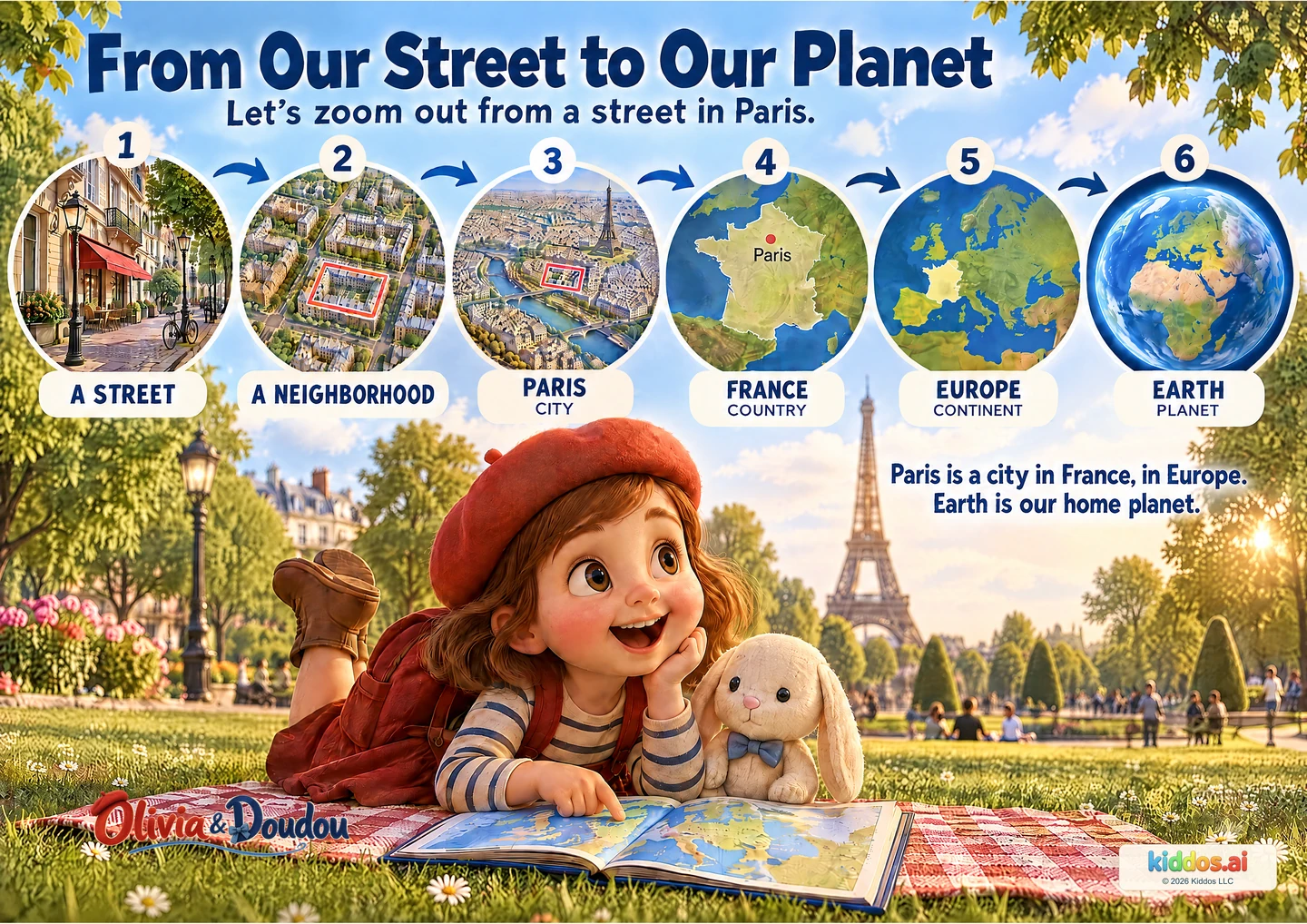
From Our Street to Our Planet
Which picture shows a larger area: the street or the city?
Look, talk & try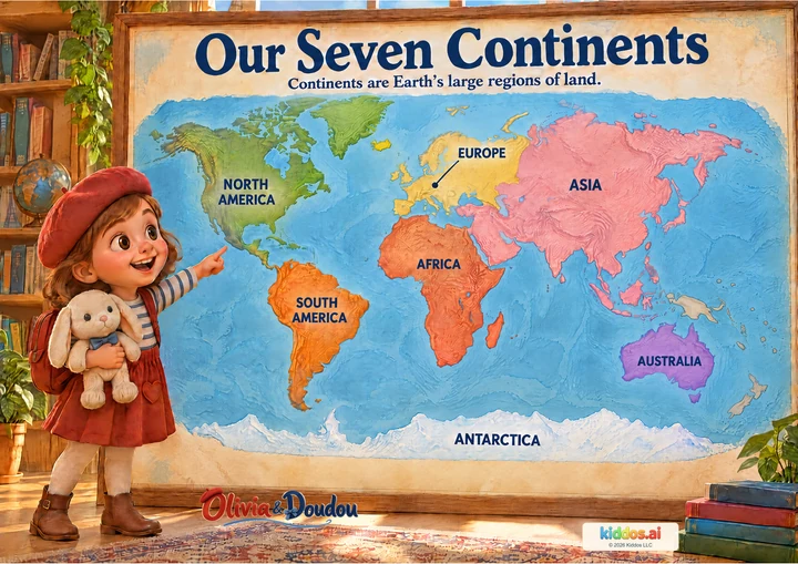
Our Seven Continents
Can you find Africa and South America? What is between them?
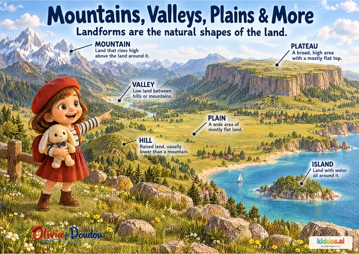
Look, talk & tryMountains, Valleys, Plains & More
Which two landforms look flat? How are they different?
Look, talk & try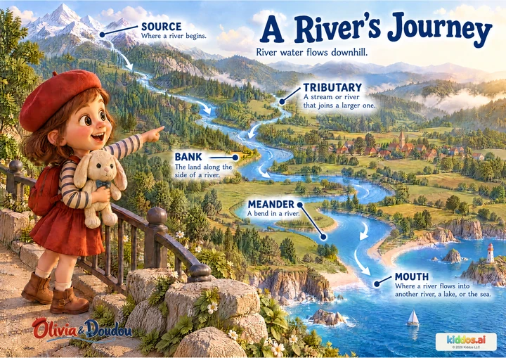
A River's Journey
Which way does the water go? What helps you tell?
Look, talk & try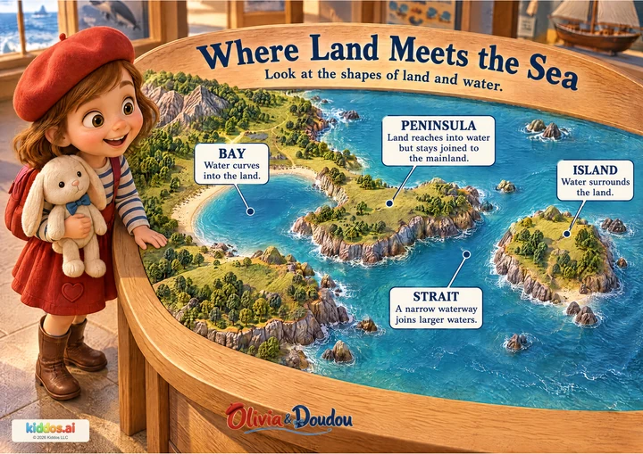
Where Land Meets the Sea
Which land has water all the way around it?
Look, talk & try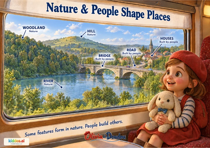
Nature & People Shape Places
Which labeled feature carries the road across the river?
Look, talk & try