

A Olivia & Doudou learning journey
Our place on Earth
How can we describe our planet and the weather in its places?
Move from a street to Earth, name its land and water, locate its hemispheres, then compare a weather observation with long-term patterns.
Begin the journeyAt your own pace.
Use one chapter at a time over several visits. Open the related notebook page only when it helps the conversation.
A discovery to listen for.
Can the child distinguish France from Europe and connect Paris to both? Can the child locate two named continents and indicate the water between Africa and South America? The child identifies one named ocean and explains, in their own way, that the waters join. The child identifies the Equator and one hemisphere, using pointing, words or an adult-supported drawing. The child distinguishes a current observation from a pattern studied over many years.
- 1
Start here
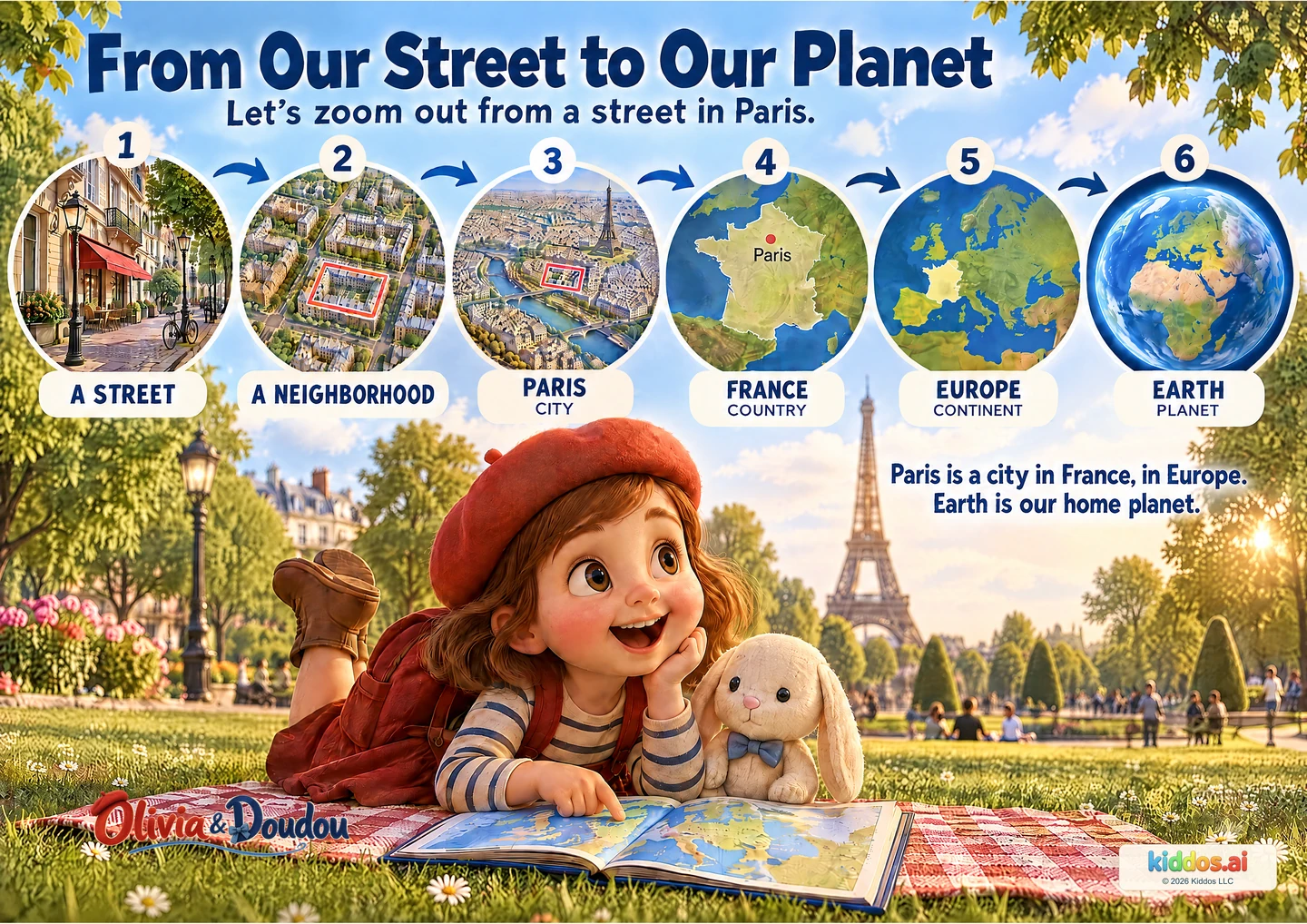
From Our Street to Our Planet
Which picture shows a larger area: the street or the city?
Use one example to distinguish city, country, continent and planet.
Explore this lesson - 2
Build on your last discovery
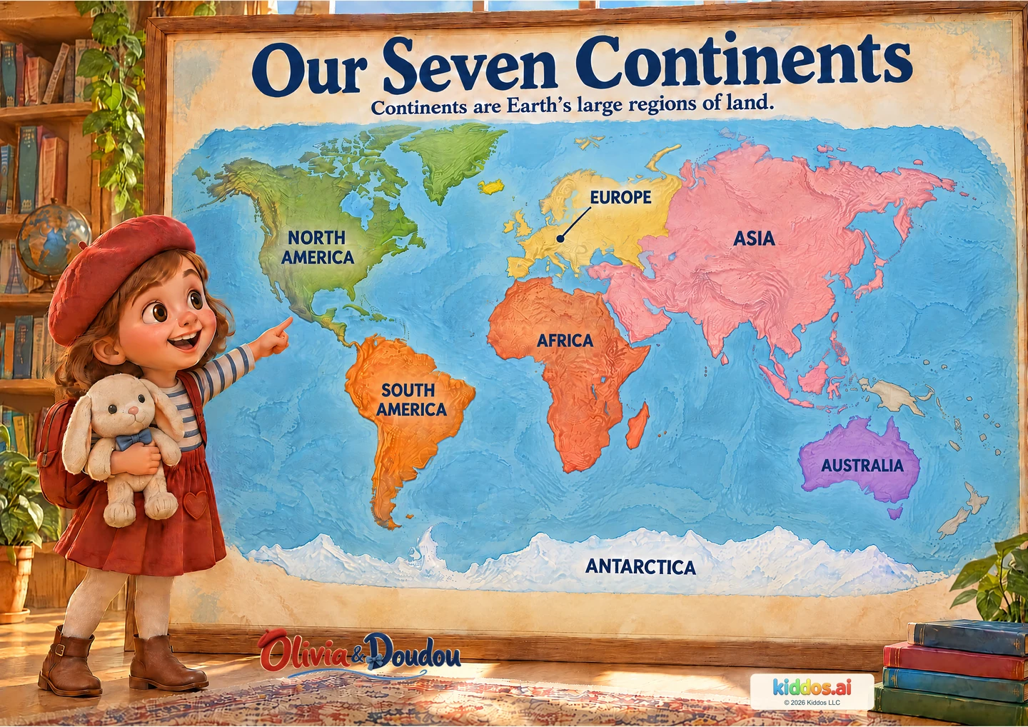
Our Seven Continents
Can you find Africa and South America? What is between them?
Name or locate continents and compare their positions on a world map.
Explore this lesson - 3
Build on your last discovery
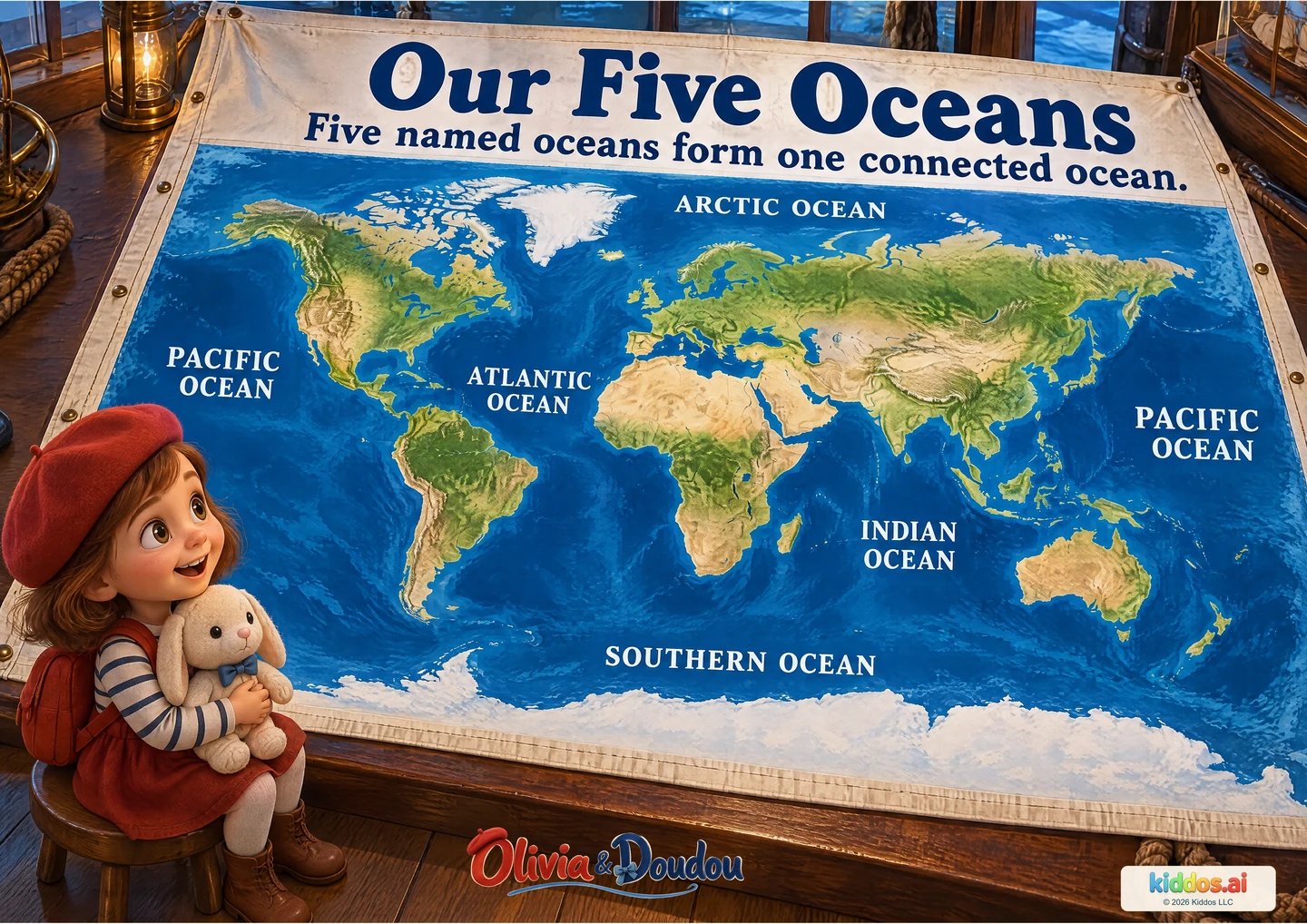
Our Five Oceans
Why are there two Pacific Ocean labels?
Locate five named ocean regions and explain that their waters connect.
Explore this lesson - 4
Build on your last discovery
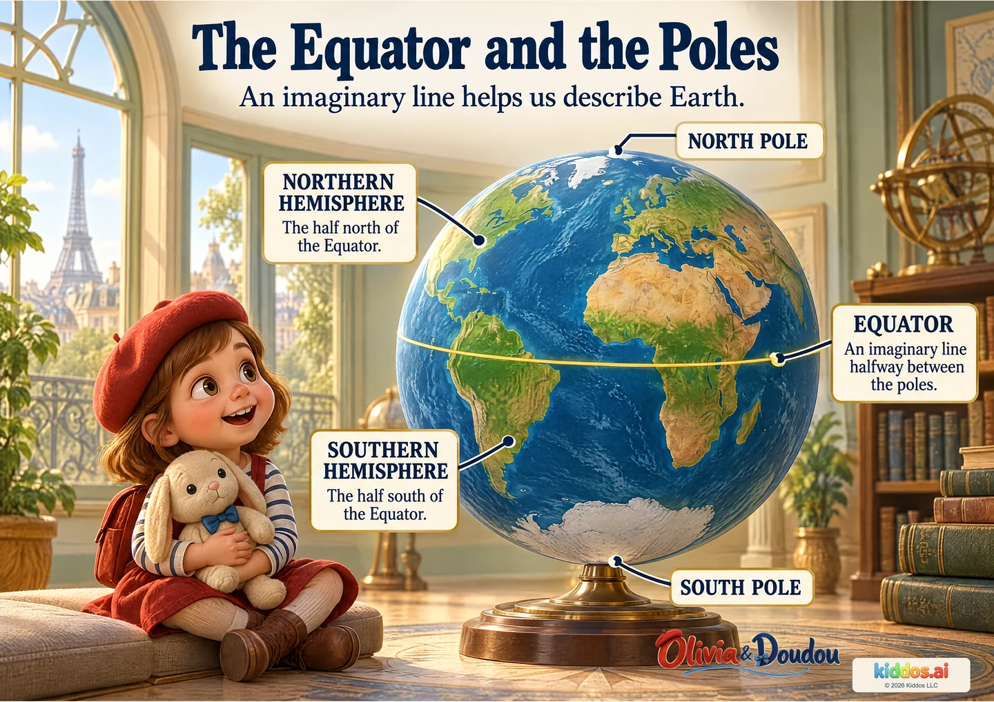
The Equator and the Poles
What does the Equator help us describe?
Locate the geographic poles and Equator, and distinguish the two hemispheres.
Explore this lesson - 5
Build on your last discovery
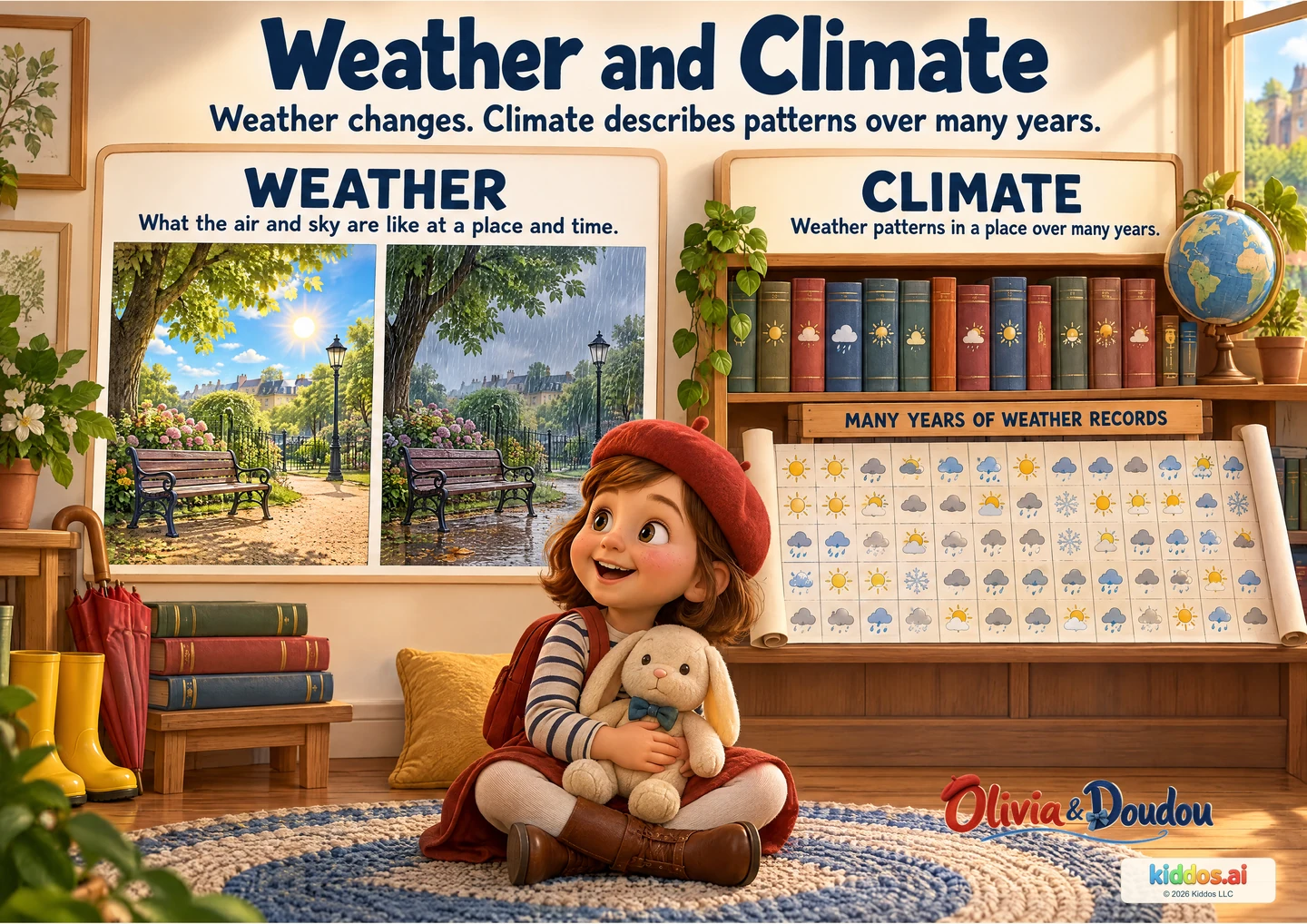
Weather and Climate
What changed between the two park pictures?
Distinguish a day’s weather from weather patterns studied across many years.
Explore this lesson
For teachers
A sequence you can adapt.
Move from a street to Earth, name its land and water, locate its hemispheres, then compare a weather observation with long-term patterns.
Paper and a pencil or crayon; the pictures can be viewed on a screen. No purchase or travel is needed. Read the answer cues and offer a described or pointed response.
- From Our Street to Our Planet
Tell a zoom-out story: Use one example to distinguish city, country, continent and planet.
Return prompt: Paris belongs to a country and a continent. Next, find Europe on the wider world map.
- Our Seven Continents
Draw a land-and-water clue: Name or locate continents and compare their positions on a world map.
Return prompt: The continents name large land regions. Next, name the connected ocean regions around them.
- Our Five Oceans
Follow the connected water: Locate five named ocean regions and explain that their waters connect.
Return prompt: Land and ocean stretch around Earth. Next, use a globe to locate the Equator and the two poles.
- The Equator and the Poles
Make a two-hemisphere picture: Locate the geographic poles and Equator, and distinguish the two hemispheres.
Return prompt: The globe helps us describe where a place is. Next, compare its weather at one time with records gathered over many years.
- Weather and Climate
Start a tiny weather record: Distinguish a day’s weather from weather patterns studied across many years.
Return prompt: We have looked at Earth and weather observations. Next, look more closely at the shapes within a landscape.
Closing check: Tell a pretend journey and explain a connection, a useful destination and one way to care for the place.
Take this journey onto paper.
The poster pack includes every lesson in this journey. The companion includes parent conversations, classroom plans and a discovery record.