
Five minutes together
Look. Wonder. Talk.
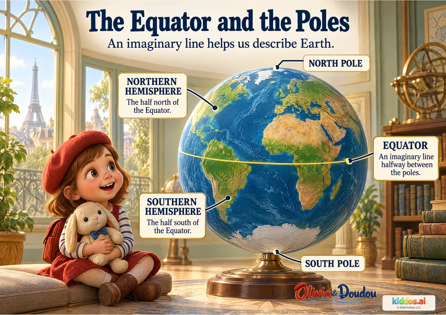
Our discovery: Locate the geographic poles and Equator, and distinguish the two hemispheres.
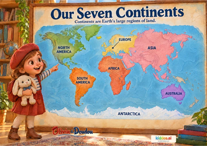
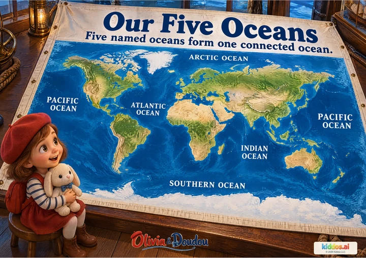
Begin with the globe, then find the thin line around its middle. Let your child trace one half of Earth before introducing the word hemisphere. Compare this globe with the accepted continents and oceans posters.
What does the Equator help us describe?
Start here
Point to the middle line and choose the half above or below it when named.
Explore further
Explain why the line is imaginary and describe a pretend journey between the two hemispheres.
Three questions to share
1What does the Equator help us describe?
Answer cue: It divides Earth into a northern half and a southern half. Each half is called a hemisphere.
2Where are the two geographic poles in this picture?
Answer cue: The North Pole is at the top of this upright globe and the South Pole at the bottom. They are opposite ends of Earth’s north–south rotation axis.
3Would a traveler find a gold stripe running all the way around Earth?
Answer cue: No. The Equator is an imaginary line used to describe locations. The gold line makes that idea visible on this globe.
If your child is unsure: Point to the middle line and choose the half above or below it when named.
Something to try together
Make a two-hemisphere picture
You’ll need: Paper and crayons; an optional large globe already available at home or school.
- Draw a large circle to represent a view of Earth. Draw a line across its middle for the Equator.
- Point to the northern half, the southern half and the two poles. An adult can write the names.
- Add a pretend journey that crosses the Equator and describe how its hemisphere changes.
What this can show
The child identifies the Equator and one hemisphere, using pointing, words or an adult-supported drawing. Keep this a drawing or pointing activity. No travel, purchase, personal location or small model pieces are needed.
Return to it: Return to the continents poster. Find Africa and compare the land on either side of the Equator using this globe.
Get the guide and discovery recordFor teachers · About 15 minutes
A small lesson with room to explore.
Learning aim: Locate the geographic poles and Equator, and distinguish the two hemispheres.
Prepare: Paper and crayons; an optional large globe already available at home or school. Read the answer cues before sharing.
- 3 min
Notice
Look together and name one visible detail before introducing new words.
- 4 min
Compare
Use the three prompts to connect the pictured evidence with the lesson.
- 5 min
Try together
Draw a large circle to represent a view of Earth. Draw a line across its middle for the Equator. Point to the northern half, the southern half and the two poles. An adult can write the names. Add a pretend journey that crosses the Equator and describe how its hemisphere changes.
- 3 min
Explain
The child identifies the Equator and one hemisphere, using pointing, words or an adult-supported drawing.
Check the idea together
The child identifies the Equator and one hemisphere, using pointing, words or an adult-supported drawing.
What to listen for
It divides Earth into a northern half and a southern half. Each half is called a hemisphere. The North Pole is at the top of this upright globe and the South Pole at the bottom. They are opposite ends of Earth’s north–south rotation axis. No. The Equator is an imaginary line used to describe locations. The gold line makes that idea visible on this globe.
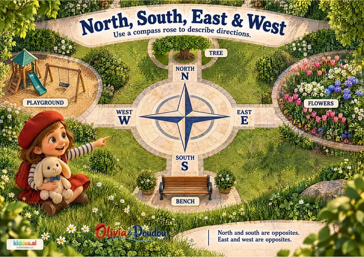
Say the positional words aloud and trace slowly. Offer a raised-line paper circle if useful; north and south do not depend on seeing different colors.