
Five minutes together
Look. Wonder. Talk.
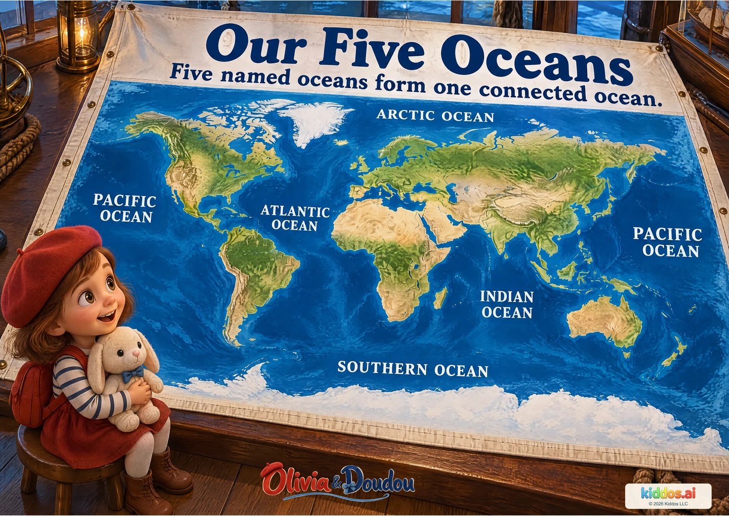
Our discovery: Locate five named ocean regions and explain that their waters connect.
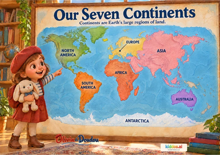
Start with the blue water. Trace a route between two named oceans with your finger, staying over water. Then compare this poster with Our Seven Continents: one names water regions, the other large land regions.
Why are there two Pacific Ocean labels?
Start here
Find land and water, then match two ocean names read aloud by an adult.
Explore further
Locate all five named regions and explain the repeated Pacific label.
Three questions to share
1Why are there two Pacific Ocean labels?
Answer cue: This flat map is cut through the Pacific. The left and right edges join on a globe, so both labels name the same ocean.
2Which ocean is between Africa and Australia?
Answer cue: The Indian Ocean. Help your child find the land shapes first, using the continents poster if needed.
3Are walls separating the five oceans?
Answer cue: No. Their waters connect. The names help us talk about different regions of one global ocean.
If your child is unsure: Find land and water, then match two ocean names read aloud by an adult.
Something to try together
Follow the connected water
You’ll need: The poster and, optionally, the Seven Continents poster or a globe.
- Find Antarctica at the bottom and the Southern Ocean around it.
- Trace through water from the Southern Ocean into the Atlantic, Indian and Pacific oceans.
- Find the two Pacific labels. Imagine bringing the map’s left and right edges together.
What this can show
The child identifies one named ocean and explains, in their own way, that the waters join. A finger trace or spoken route is enough. Do not cut or fold the poster; no water experiment or travel is required.
Return to it: Cover one ocean name. Can your child locate it by describing the land beside it?
Get the guide and discovery recordFor teachers · About 15 minutes
A small lesson with room to explore.
Learning aim: Locate five named ocean regions and explain that their waters connect.
Prepare: The poster and, optionally, the Seven Continents poster or a globe. Read the answer cues before sharing.
- 3 min
Notice
Look together and invite one observation before introducing the vocabulary.
- 4 min
Compare
Use the three discussion prompts, following the picture rather than expecting memorized definitions.
- 5 min
Try together
Find Antarctica at the bottom and the Southern Ocean around it. Trace through water from the Southern Ocean into the Atlantic, Indian and Pacific oceans. Find the two Pacific labels. Imagine bringing the map’s left and right edges together.
- 3 min
Explain
The child identifies one named ocean and explains, in their own way, that the waters join.
Check the idea together
The child identifies one named ocean and explains, in their own way, that the waters join.
What to listen for
This flat map is cut through the Pacific. The left and right edges join on a globe, so both labels name the same ocean. The Indian Ocean. Help your child find the land shapes first, using the continents poster if needed. No. Their waters connect. The names help us talk about different regions of one global ocean.
Read names aloud and allow the child to point. Use enlarged sections while retaining a whole-map view; describe land shapes without relying on color alone.